 The Aosta Trip
Tsatelet Nature Reserve
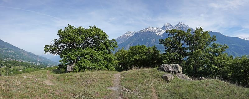
On the summit, a late Neolithic settlement from around 3000 BC and its necropolis
The rocky hill closes off the Aosta plain to the north-east, at the mouth of the Great St Bernard valley, where the Buthier flows into the Dora: steep sides and a flat top, with rocks smoothed by glaciers and erratic boulders of more than 100 cubic metres. The woodland is downy oak and Scots pine, with plants of Mediterranean and steppe origin: Valeriana tuberosa, which within the Alps grows only in the Aosta Valley, Pulsatilla montana and Achillea tomentosa. From the summit you can see the Aosta plain, the Great St Bernard valley, the Becca di Nona, Mont Emilius and the Grand Combin; during migration periods it is an observation point for birds of prey and corvids. On the summit, a mound could be an Iron Age tomb.

Visiting
Free access all year round, best in spring and autumn; the official itinerary recommends it from April to October (undated regional tourism pages, read on 01/10/2026). By car: from the Aosta Est exit of the A5 you take the SS 26 towards the city, and at the second roundabout turn right onto the SR 17 for Porossan as far as the hamlet of Serod; past Serod, towards Saint-Christophe, a small car park marks the entrance to the reserve. The municipality mentions a paved car park and a lit path leading to the recreation and nature area. On foot from Aosta, path 6: from the Arch of Augustus you cross the stream on the Roman Bridge and turn left; at the roundabout turn right, the road climbs and after about 100 metres you take the small road on the left; you skirt the Fontaine Saint-Ours park and climb to Busseyaz, then the road becomes a dirt track; leaving the turn-off on the right, at the next fork go first right and then left, and then the path branching off to the right reaches the recreation area and climbs to the top of the reserve. 2.1 km, 175 m height gain (189 according to the other official page), 45 minutes, difficulty E. No closures found in the official sources consulted (2026).
Trails
- from Via Scuola Militare Alpina (595 m) · ↑ 177 m · 44 min out, 32 min back · 2.1 km · E Walk · path 6 · April–October
Trails: data provided by the Struttura Forestazione e Sentieristica of the Aosta Valley Autonomous Region.
History
The Tsatelet hill has the smooth, rounded shape of landforms that have been overrun by glaciers. Until about 10,000 years ago the two great valleys that meet here, the Dora Baltea valley and the Great St Bernard valley, were filled with ice, which shaped the rocks into roches moutonnées and left erratic boulders of more than 100 cubic metres.
The first human presence dates from the late Neolithic, around 3000 BC: a settlement occupied the top of the hill, with a burial area probably located in the hollow to the north. Fragments of artefacts have been collected and, not far from the boundaries of the reserve, the capstone of a dolmen was discovered. On the summit, a mound could, from its shape and size, be a tomb from the period of the Salassi, in the Iron Age (seventh to fifth centuries BC).
The regional nature reserve was established on 23 February 1993 by decree no. 214 of the President of the Regional Government: 14 hectares between 720 and 796 metres, in the municipalities of Aosta and Saint-Christophe, managed by the Region. It protects a xerothermic environment, dry and warm, due to the low rainfall of the main valley and the strong exposure to the sun: the woodland is downy oak with Scots pine and juniper, and on the driest slopes grow plants of Mediterranean and steppe origin, including Valeriana tuberosa, which within the Alps reaches only the Aosta Valley, Pulsatilla montana, which flowers very early, and Achillea tomentosa, as well as Sedum and Sempervivum. Among the animals are the fox, squirrel, hare, weasel and hedgehog; among the birds the great spotted woodpecker, the green woodpecker, tits and the nightjar, a crepuscular bird that is hard to see.
Around the reserve Aosta municipality has set up a leisure area, also known as Quota B.P., from the name the Aosta scouts give the hill in memory of Baden-Powell: a multi-purpose sports ground and a pitch for the game of palet, both floodlit, a play area along a woodland path, a building with toilets and changing rooms in stone, wood and stone roof slabs, a paved car park and a lit path linking it to the nature area, with wooden fences along the paths. A dense network of paths runs inside and around the reserve.
Nearby
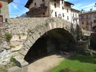 Aosta Roman BridgeIts single arch, 17 metres wide, now spans a dry bed
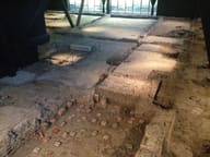 Consolata Roman VillaDiscovered by chance in 1971 during the construction of a building
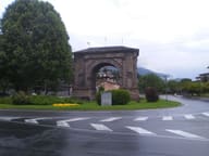 Honorary Arch of AugustusSingle archway 11.40 metres high, now in the middle of a roundabout
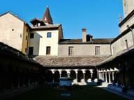 Sant'Orso Collegiate ChurchA capital in the cloister is dated 1133: the canons' communal life began here
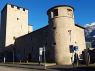 Bailiffs' TowerResidence of the bailiffs, then a prison until 1984, now the Conservatoire
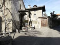 San Lorenzo Early Christian Church Archaeological AreaFifth-century Latin-cross basilica, a few metres below the floor of the present church