 The Aosta Trip
Rifugio Chaligne
Refuge de Chaligne
An old stone and wood alpine-pasture chalet, which became a hut on 21 June 2006
It stands at the Alpe Chaligne, on the path that climbs from Buthier to the Pointe Chaligne (2,607 m). The kitchen mainly uses cheeses from the alpine pastures still active in the basin. The hut also offers the StarsBox, half tent and half cabin, which opens towards the sky so you can sleep under the stars. From here paths set off for the Mont Fallère (3,090 m) and the Mont de la Tsa.

Visiting
From 20 June to 13 September. No winter opening. 36 beds. From Buthier (1,417 m), a hamlet of Gignod: on foot, via the Alpe Mendey (1h15 (1h33–1h35 in other listings), about 520 m height gain, path 3A, E). From Buthier: by mountain bike on the rural road (5 km). Phone: +39 348 3366924.
Trails
- from Buthier (1,417 m) · ↑ 516 m · 1 h 33 min out, 58 min back · 2.8 km · E Hike · path 3A · May–October
Trails: data provided by the Struttura Forestazione e Sentieristica of the Aosta Valley Autonomous Region.
History
The hut opened on 21 June 2006 at the Alpe Chaligne, in the municipality of Gignod. It came from the renovation of a stone and wood mountain chalet, with local materials and furnishings made partly with timber from land improvement work in the area. The hot water comes from solar panels.
Nearby
- Punta ChaligneEvery 16 August two processions, from Gignod and from Excenex, climb to the summit crosses
- Alpe ArsAlpine pasture at 1,975 m, reached almost on the level along the ru Collet, in the Ars valley
- Ru NeufMedieval channel carrying the water of the Artanavaz from Étroubles to the Aosta hillside
- Ru BourgeoisFourteenth-century channel that crosses the Aosta hillside, lower down than the Ru Neuf
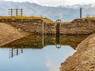 Lago FallèreLake at 2,415 m below Mont Fallère, with a view of the Grivola, Gran Paradiso and Emilius
- Becca FranceThe landslide of 6 July 1564 that destroyed Thora broke away from its east side