 The Aosta Trip
Lago Fallère
Lac Fallère
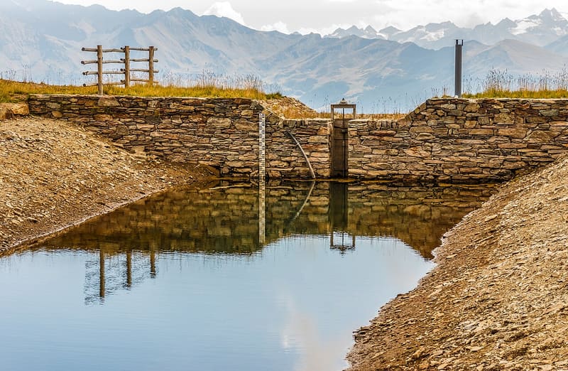
Lake at 2,415 m below Mont Fallère, with a view of the Grivola, Gran Paradiso and Emilius
The lake lies in a wide basin at the foot of the south slopes of Mont Fallère and Mont d'Arsy. To the south you can see the Grivola, Gran Paradiso, the Ciarforon, the Becca di Monciair and the Emilius. Early in the season it may still be covered in ice. Not far away is the lac des Feuilles.

Trails
- from Thouraz (1,631 m) · ↑ 802 m · 2 h 38 min out, 1 h 44 min back · 5.7 km · E Hike · path 8A · July–September
Trails: data provided by the Struttura Forestazione e Sentieristica of the Aosta Valley Autonomous Region.
History
On the first stretch of the ascent from Thouraz you can see the Becca France, from which the landslide that destroyed the village of Thora broke away on 6 July 1564. The village was rebuilt on a higher shelf and took the name Thouraz.
Nearby
 Mont FallèreBelow the summit, the ruins of the Regina Margherita hut (1884) and the Pansa bivouac (2022)
 Rifugio Mont FallèreBetween 350 and 400 sculptures by Siro Viérin along the path from Vetan
- Becca FranceThe landslide of 6 July 1564 that destroyed Thora broke away from its east side
- Punta ChaligneEvery 16 August two processions, from Gignod and from Excenex, climb to the summit crosses
- Alpe ArsAlpine pasture at 1,975 m, reached almost on the level along the ru Collet, in the Ars valley
- Rifugio ChaligneAn old stone and wood alpine-pasture chalet, which became a hut on 21 June 2006