 The Aosta Trip
Punta Chaligne
Pointe de Chaligne
Every 16 August two processions, from Gignod and from Excenex, climb to the summit crosses
Two large crosses mark the summit. From Buthier the path climbs through alpine pastures and woods to the Cresta Tardiva, recognisable by a radio repeater, then to the Col Tardiva (2,410 m) and the summit. From the summit you can see peaks and glaciers of the Graian and Pennine Alps.

Trails
- from Buthier (1,413 m) · ↑ 1,197 m · 3 h 35 min out, 2 h 16 min back · 6.5 km · E Hike · path 3 · June–September
- from Chez-Les-Blancs (1,295 m) · ↑ 1,277 m · 3 h 50 min out, 2 h 22 min back · 6.6 km · E Hike · path 4 · June–September
- from Echevennoz (1,256 m) · ↑ 1,468 m · 4 h 27 min out, 2 h 41 min back · 6.8 km · E Hike · path 5A - 5 - 4 · July–September
- from Excenex (1,036 m) · ↑ 1,560 m · 4 h 40 min out, 2 h 51 min back · 7.7 km · E Hike · path 1A - 2A · June–September
- from Gignod (975 m) · ↑ 1,661 m · 5 h 4 min out, 3 h 10 min back · 8.9 km · E Hike · path 2B · June–September
- from Cré (894 m) · ↑ 1,701 m · 5 h 8 min out, 3 h 12 min back · 9.2 km · E Hike · path 2 · June–September
- from Pont Avisod (668 m) · ↑ 1,940 m · 5 h 55 min out, 3 h 38 min back · 9.8 km · E Hike · path 3 - 5 - 4 · June–September
Trails: data provided by the Struttura Forestazione e Sentieristica of the Aosta Valley Autonomous Region.
History
On 16 August processions climb to the summit from two sides, along two different paths that meet before the final ascent: from Gignod, and from Excenex, a hamlet of Aosta, with the faithful of Arpuilles. In Gignod the great church bell rings at 3:30 and the procession sets off at 4:00, passing the oratory of Chez Percher, Planet and the Plan du Débat.
Nearby
- Rifugio ChaligneAn old stone and wood alpine-pasture chalet, which became a hut on 21 June 2006
- Alpe ArsAlpine pasture at 1,975 m, reached almost on the level along the ru Collet, in the Ars valley
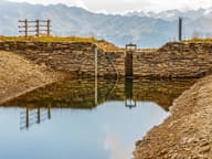 Lago FallèreLake at 2,415 m below Mont Fallère, with a view of the Grivola, Gran Paradiso and Emilius
- Becca FranceThe landslide of 6 July 1564 that destroyed Thora broke away from its east side
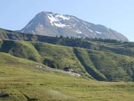 Mont FallèreBelow the summit, the ruins of the Regina Margherita hut (1884) and the Pansa bivouac (2022)
- Ru NeufMedieval channel carrying the water of the Artanavaz from Étroubles to the Aosta hillside