 The Aosta Trip
Becca France
The landslide of 6 July 1564 that destroyed Thora broke away from its east side
There is a cross at the summit. You can see the Grivola, the Gran Nomenon, the Becca di Nona, the Emilius, the Rutor and Monte Rosa, with Mont Fallère and the Punta Chaligne close by. The scar where the landslide broke away takes up the whole eastern side, now covered with fir and larch, and can also be seen from the valley floor towards Gressan and Jovençan.

Trails
- from Verrogne (1,578 m) · ↑ 719 m · 1 h 42 min out, 1 h 3 min back · 4.8 km · EE Expert · path 11B - 9A · June–September
Trails: data provided by the Struttura Forestazione e Sentieristica of the Aosta Valley Autonomous Region.
History
At 6:00 in the morning on 6 July 1564 a great landslide broke away from the eastern side and buried the village of Thora, in the valley of the Clusellaz stream. About 500 people died: it is the worst known natural disaster in the Aosta Valley. The village was rebuilt on a safer terrace under the name of Thouraz. In the Goille Pesse wood a large boulder bears an inscription in memory of Thora.
Nearby
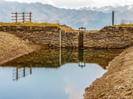 Lago FallèreLake at 2,415 m below Mont Fallère, with a view of the Grivola, Gran Paradiso and Emilius
- Punta ChaligneEvery 16 August two processions, from Gignod and from Excenex, climb to the summit crosses
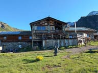 Rifugio Mont FallèreBetween 350 and 400 sculptures by Siro Viérin along the path from Vetan
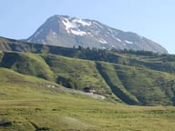 Mont FallèreBelow the summit, the ruins of the Regina Margherita hut (1884) and the Pansa bivouac (2022)
- Rifugio ChaligneAn old stone and wood alpine-pasture chalet, which became a hut on 21 June 2006
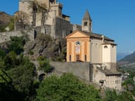 Saint-Pierre CastleThe core dates from the twelfth century, the four corner turrets from the nineteenth