 The Aosta Trip
Saint-Nicolas Cross-Country Trails
At Fossaz a 2.5 km loop is floodlit and you can ski in the evening too
You start from the Foyer de Fond at Fossaz, at about 1,200 m, with a bar, restaurant, changing room and showers. The loops are 2.5, 4.5 and 6.5 km long, intermediate: they run along the Bois de la Tour, pass the seventeenth-century parish church and drop towards the badlands. In all there are 6.5 or 7 km. There is also a biathlon range.
The trails belong to the municipality. The Saint-Nicolas ski club was founded in 1948; in the 1980s the floodlit Fossaz loop hosted night relays with World Cup athletes. From the course you can see the Grivola, Mont Emilius and the peaks above Pila.

Visiting
2025/26 season: day pass €6, concession €4 (aged 5–13 and over-65s). Tickets at the start, from the pisteur at the Foyer de Fond, or online at scinordicovalledaosta.it. Evening opening from 18:30 to 21:30 on Tuesdays and Fridays, sometimes on Thursdays too. For groups of at least 15 people the municipality opens on request, with two days' notice. 2026/27 season: dates not yet published; opening depends on the snow.
Pistes
Floodlit loop, 2.5 km — Created from the 4.5 km loop and floodlit along its whole length. Blue, or of medium difficulty.
Loop 4.5 km — Of medium difficulty. From the Foyer de Fond it climbs to the edge of the Bois de la Tour, follows its north-western edge, goes back to the parish church and returns to the Foyer with descents and ups and downs on the north-eastern side.
Fossaz trail, 6.5 or 7 km — At the fork near the monument to the Abbé Cerlogne, you turn right. Two fairly demanding descents go down towards Avise to the lowest point, from which you can see the badlands; a climb, also fairly demanding, leads back towards the Bois de la Tour and onto the 4.5 km loop.
The terrain — Flat stretches alternating with ups and downs, some of them fairly difficult. Besides the pines of the Bois de la Tour, there are many birches along the course. There is also an open area for sledges and bobsleighs.
Nearby
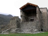 La Mothe CastleClosed since 2026 for work on the Museum of the Alpine Future, €6.5 million from the PNRR
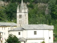 Parish Museum of Sacred ArtWooden statues and gold work from the fifteenth to the nineteenth century in the church of San Brizio
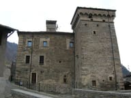 Avise CastleThe corbel room has fourteen carved wooden corbels
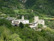 AviseThe castle, the Maison de Blonay and the Cré fortified house: three homes of the lords of Avise
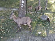 Parc Animalier d'IntrodIbex, chamois, wolves and birds of prey along a 1.5 km path with a 150 m height gain
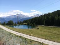 Lago di JouxA small lake in a pine wood at 1,902 m, with a little chapel in a nearby clearing