 The Aosta Trip
Testa di Comagna
Tête de Comagne
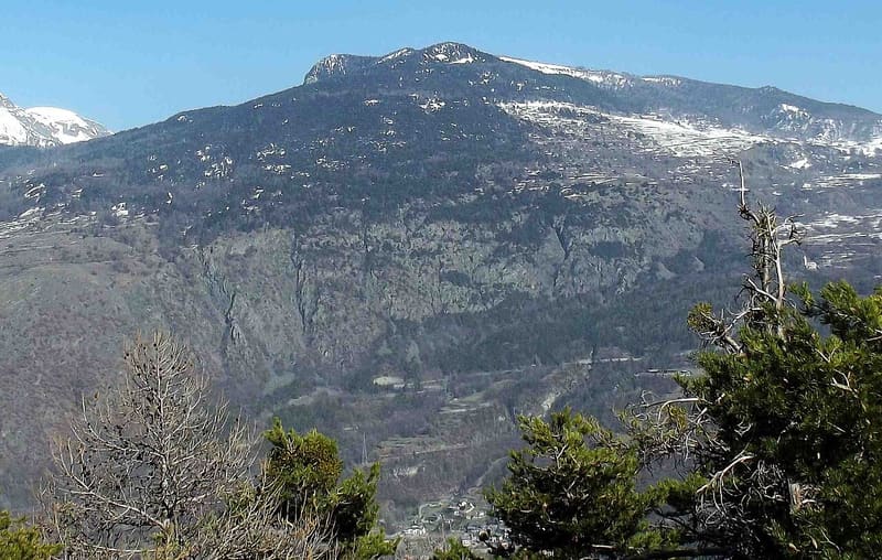
Stone cross on the summit, with a view of Mont Néry, Mont Avic and Mont Blanc
The summit lies on the watershed between the main valley and the Val d'Ayas, far from higher peaks, and looks far into the distance. You can see Mont Néry with the Dames de Challand, Mont Avic, the Emilius–Tersiva chain, Mont Blanc and the Matterhorn. Half an hour before the summit, on the path from the Col de Joux, there is a viewpoint with benches overlooking Brusson.

Trails
- from Col de Joux (1,639 m) · ↑ 458 m · 1 h 20 min out, 48 min back · 2.4 km · E Hike · path 1B · June, July, August, September, October
- from Arbaz (1,499 m) · ↑ 608 m · 1 h 55 min out, 1 h 13 min back · 3.7 km · E Hike · path 18 - 5 · June, July, August, September
- from Brusson (1,277 m) · ↑ 820 m · 2 h 30 min out, 1 h 36 min back · 5 km · E Hike · path 1 - 1B · June, July, August, September
- from Eresaz (1,195 m) · ↑ 1,030 m · 3 h 5 min out, 1 h 53 min back · 4.4 km · E Hike · path 1 - 5 · June, July, August, September, October
Trails: data provided by the Struttura Forestazione e Sentieristica of the Aosta Valley Autonomous Region.
History
On the summit there is a stone cross on a masonry base; since 2018 the summit book has been at the back of the base. On the eastern slope, between Challand-Saint-Anselme and Brusson, there are old mines.
Nearby
 Col de JouxIn the woods at the pass flows the Ru Courtaud, an irrigation channel granted in 1393
- Col TzecorePlateau among larches with a picnic area and views of Mont Blanc and Monte Zerbion
- Chamousira Gold MineTunnel dug into the Fenilliaz vein, worked from 1900 until the early 1980s
- Brusson Cross-Country TrailsBetween 1982 and 2001 the Vollon plateau hosted five World Cup races
 Graines CastleBeside the walls, the Romanesque church of San Martino with herringbone walls
- Brusson, EstoulSunny runs in the hamlet of Estoul, above Brusson: 9 runs, none of them black