 The Aosta Trip
Roman Road to Gaul at Bard
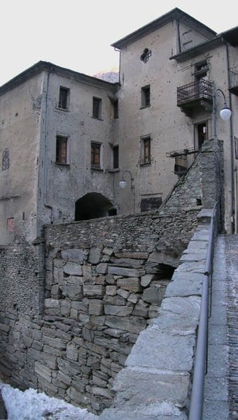
The substructures above the fort's car park are 16 metres high and 58 long
The most imposing stretch can be seen above the fort's underground car park: a massive wall of large squared stone blocks, 16 metres high and 58 long, which supports the Roman road surface from outside. In the rest of the village the modern road follows the ancient route, with stretches of exposed cut rock and retaining walls of polygonal boulders that you can see as you walk between the houses.

Visiting
Free, with no opening hours or ticket: you can see the substructures above the fort's car park as you pass through the centre of Bard or if you park there. Another stretch of the road, towards Pont-Saint-Martin, was reported impassable because of rockfall: before setting off along that stretch it is advisable to check with the tourist office (0125 804843).
History
The consular road to Gaul was built between the founding of Eporedia, present-day Ivrea (about 100 BC), and that of Augusta Praetoria, present-day Aosta (25 BC), to link the Po Valley to the Alpine passes of the Little and Great St Bernard, towards Gaul. At Bard the road had to get past a rocky spur squeezed between the Dora Baltea river and the mountain, the same spot where centuries later the fort would be built: the Romans built substructures of large squared stone blocks there to support the roadbed from outside, about 4.75 metres wide, sufficient for two carts to pass each other. According to the sources, the construction required a large number of slave workers.
In Roman times the road was for centuries the main transit route towards Gaul, so much so that in the Middle Ages control of the passage at Bard became a source of wealth for the local lords, who imposed tolls on merchants and travellers: a power that during the thirteenth century passed to the House of Savoy, which took control of Bard in 1242.
After the Roman period the route was not abandoned: the road that still crosses the village of Bard today closely follows the ancient course, and the Roman substructures have remained in view, incorporated into the built landscape of the village, although no recent systematic archaeological excavations of them are documented.
Today the best-preserved stretch can be seen above the underground car park of Forte di Bard: a massive wall of squared blocks 16 metres high and 58 long, freely visible to anyone passing through the village or parking their car there. Other stretches, with exposed cut rock and retaining walls of polygonal boulders, can be found as you walk between the houses; a stretch towards Pont-Saint-Martin, on the other hand, was reported closed because of rockfall.
Nearby
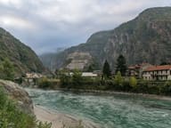 Forte di BardIt held up the Napoleonic army for about two weeks in May 1800
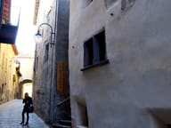 Bard VillageThe bullet holes from the Napoleonic siege of 1800 remain on Palazzo Nicole
 Roman Road to Gaul and Donnas ArchThe stretch cut into the rock is 221 metres long, with walls up to 13 metres high
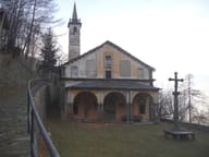 Machaby SanctuaryRebuilt in 1687, restored in 2021–2023; feast of Our Lady of the Snows on 5 August
 Col FenêtreIn the meadows below the pass the rare wild peony flowers in early June
- 'L CastelThe museum on the first floor recalls the bombing of the town on 23 August 1944