 The Aosta Trip
Ru du Mont
Ru from 1400, rebuilt in 1949 with a tunnel of about 750 m cut into the rock
The route ends at Châtellair, on the pastures of Doues, with the chapel of the Santissima Trinità on a knoll at 1,430 m overlooking the village. From the meadows you can make out the Grivola and Mont Emilius; along the ru towards Ollomont you can see the Becca di Viou and the Grand Combin. The highlight is the dark tunnel of the ru, to be walked with a torch.

Trails
- from Rey (1,380 m) · ↑ 78 m · 1 h 3 min out, 57 min back · 3.8 km · E Walk · path 1 · May–October
- from Vaud (1,470 m) · ↑ 72 m · 1 h 19 min out, 1 h 13 min back · 4.8 km · E Hike · path 1 · June–September
- from Rey (1,380 m) · ↑ 390 m · 1 h 55 min out, 1 h 46 min back · 4.6 km · E Hike · path 1 · May–October
Trails: data provided by the Struttura Forestazione e Sentieristica of the Aosta Valley Autonomous Region.
History
The ru carries water from Vaud, in Ollomont, to the fields of Doues. Built around 1400, it was abandoned because of landslides and cracks; in 1949 it was rebuilt with a tunnel on average 1.80 m high and just over a metre wide. A legend, told on a panel at the tunnel exit, says that a keeper killed the white snake in which the Fairy of the Ru lived: from then on the channel filled with cracks.
Nearby
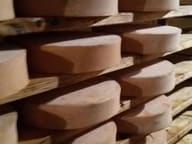 Fontina Museum and Visitor CentreThe wheels mature for 80 days in the tunnel of an old mine, a store since 1961
- Ollomont Cross-Country TrailsFrom the Ollomont trails you can see the Grand Combin, over 4,000 m, and Mont Vélan
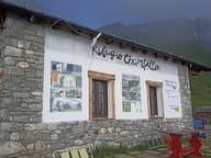 Rifugio Champillon Adolphe LeteyDedicated to Adolphe Letey, mayor of Doues from 1951 to 1990; an hour from the car
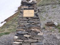 Col ChampillonPass on the Alta Via 1 and the Tor des Géants, with views from Mont Blanc to the Grand Combin
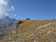 Bivacco Regondi-GavazziA 16-place wooden bivouac hut above Lago Leitou, facing Mont Gelé
- Ru de MenouveRu piped under a level dirt track as far as Alpe Ponteille, facing Mont Fallère