 The Aosta Trip
Ru Courtaud
Ru Courtod
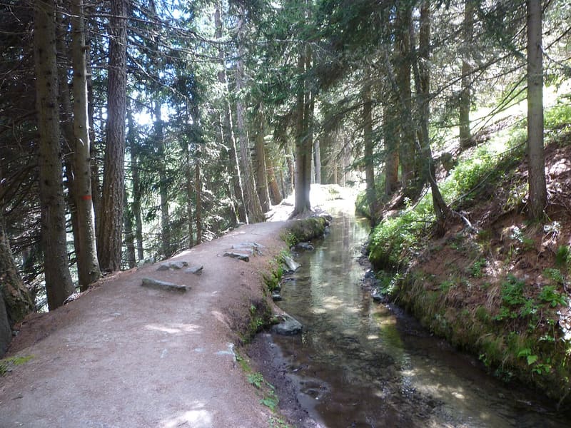
25 km channel dug between 1393 and 1433 to bring water from the Ventina to Saint-Vincent
From Barmasc the path follows the bank of the channel on the level, with many open sections, through grassland and alpine pastures: Chavannes, Granaz, Soudaz. Along the whole route the ru passes through 14 tunnels cut into the rock.

Trails
- from Lignod (1,637 m) · ↑ 294 m · 54 min out, 32 min back · 1.6 km · Hike · path 5D
- from Parcheggio Barmasc (1,898 m) · ↑ 174 m · 1 h 46 min out, 1 h 34 min back · 5.9 km · T Walk · path 5 · June, July, August, September
Trails: data provided by the Struttura Forestazione e Sentieristica of the Aosta Valley Autonomous Region.
History
The ru was dug with shovel and pick by the ‘free men’ of the Saint-Vincent hillside, who had fertile land but no water: the nearest glacier was the Ventina, on Monte Rosa, 25 km away. After the plague of 1630 the channel fell into ruin. In the 1980s it was partly piped, and the sections left open have become a walk.
Nearby
 Monte FacciabellaFrom the summit ridge you can see Castore, Polluce, the Lyskamm and the Breithorn
- AntagnodThe Vascotcha run is homologated for international downhill and super-G races
 Monterosa Ski, Champoluc and FracheyFrom Champoluc you reach Gressoney and Alagna on skis, with a single ski pass
- MascognazWalser village recorded since 1323, with rascards and the chapel of San Grato; waterfall below
- Monterosa Spa, ChampolucOutdoor pool with whirlpool jets facing Monte Rosa, in the former ice rink
 AntagnodIn the parish church of San Martino, a three-tiered Baroque altar consecrated in 1716