 The Aosta Trip
Mascognaz
Walser village recorded since 1323, with rascards and the chapel of San Grato; waterfall below
The village has rascards, very narrow lanes, a drinking trough and the chapel of San Grato. From the village the view stretches from Monte Zerbion to Monte Rosa. Below, at the mouth of the gorge, the stream forms the Mascognaz waterfall, about 50 m high, 15 minutes from Champoluc (path 14D).

Trails
- from Champoluc (1,560 m) · ↑ 255 m · 47 min out, 30 min back · 1.6 km · E Walk · path 14D · June, July, August, September
- from Amponey (1,553 m) · ↑ 309 m · 1 h out, 38 min back · 1.8 km · E Hike · path 14B · June, July, August, September
Trails: data provided by the Struttura Forestazione e Sentieristica of the Aosta Valley Autonomous Region.
History
The first document that mentions the village dates from 1323. Rascards are wooden granaries set on large stone mushrooms, which kept mice away. Today the village has been restored as an albergo diffuso. In winter the frozen waterfall becomes an ice-climbing route.
Nearby
- Rifugio Vieux CrestConverted from the hut keepers' great-grandfather's Walser rascard, 5 minutes from the gondola
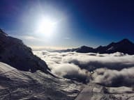 Monterosa Ski, Champoluc and FracheyFrom Champoluc you reach Gressoney and Alagna on skis, with a single ski pass
- Monterosa Spa, ChampolucOutdoor pool with whirlpool jets facing Monte Rosa, in the former ice rink
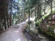 Ru Courtaud25 km channel dug between 1393 and 1433 to bring water from the Ventina to Saint-Vincent
- Ayas Cross-Country TrailsThe Ayas trails pass through eight hamlets, with views of the Monte Rosa glacier
- AntagnodThe Vascotcha run is homologated for international downhill and super-G races