 The Aosta Trip
Pontboset Bridges
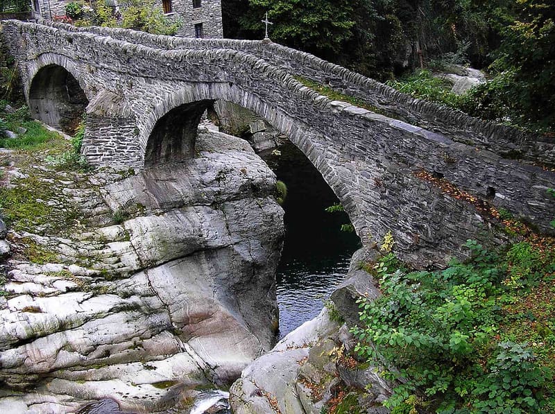
Six stone bridges over the Ayasse gorges on a 3.4 km loop from Pontboset
The village lies where the Ayasse receives the Brenve and the Manda, and the three streams have carved narrow gorges between smooth rocks and chestnut woods. A 3.4 km loop from the main village crosses six bridges, among them the humpback bridge of Bozet over the Ayasse, where the mule track to Piolly and Fournier starts, the three-arched bridge towards the Envers, the Vaseras bridge over the Manda and the stone bridge between Savin and Fassiney, dating from 1878. Beneath the bridges the water runs in clear pools; on the Brenve, a little upstream, lies the Ratus gorge.

Visiting
By car: from Hône the regional road for Champorcher until past the village of Pontboset; on the left the road goes down to the village, cars near the Chez Isabel hotel (regional itinerary, 2026) or in the car park in front of the town hall. The six-bridge circuit: start and finish at the main village (780 m), path 2, 3,420 m, +345 m, 55 minutes out and 45 back, difficulty E, period April–October (regional fact sheet, 2026): from the car park you go down to the Ayasse and along the mule track to the Frontière bridge, then the long bridge over the Brenve, the road to the Crest, the bridge over the Manda, the stone bridge over the Ayasse and the climb back up to Vareisa. The Sentiero dei ponti e degli orridi, with blue waymarks, adds the Ratus gorge with short stretches equipped with rope: 2 hours out and 2 hours 15 back, difficulty T2 (route description from 2009 updated in 2026). The gorge can only be reached on foot, not recommended for people with reduced mobility (municipality). Many bridges can also be seen from points reached on asphalt roads.
History
Pontboset is made up of small villages scattered across the middle Champorcher valley, on land cut by the Ayasse, which over millennia has carved deep gorges, and by its tributaries the Brenve and the Manda. The confluence of the three streams made many bridges necessary, and from the bridges came the name of the village and the bridge on the municipal coat of arms.
From the eleventh century the village belonged to the lords of Bard, like the rest of the valley; it then passed partly under the direct rule of the House of Savoy and partly to the lords of Pont-Saint-Martin. In the seventeenth century, under Count Jean-Jacques Nicole de Bard, a foundry known as the nail factory was set up at Fabrique, and the parish church of San Grato was built where a chapel had stood before: until then people went down to Hône for mass. In 1682 Pontboset was enfeoffed, together with Champorcher, to the noble Freydoz family. The stone bridges, mostly humpbacked, date from this period or a little earlier: late medieval according to one source, seventeenth-century according to others, which link them to the work of the foundry.
Between Savin and Fassiney the wooden bridge was replaced in 1878 by a stone one, which since then has not given way to any flood. Today a waymarked loop from the main village crosses six bridges, and the Sentiero dei ponti e degli orridi, with blue waymarks, follows the Brenve up to the Ratus gorge, which you view from below starting from Frontière or from above, from the third hairpin bend of the road to the Crest. In 2025 the municipality, about 170 inhabitants, was named the most virtuous in Italy for zero land consumption.
Nearby
 Retempio Sanctuary1835 sanctuary with a view of Monte Rosa and the Matterhorn, the destination of a procession on 2 July
 Forte di BardIt held up the Napoleonic army for about two weeks in May 1800
 Bard VillageThe bullet holes from the Napoleonic siege of 1800 remain on Palazzo Nicole
- Lago di LietSmall snowmelt lake below the Bec delle Strie, at 1,710 m, above the Donnas vineyards
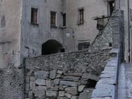 Roman Road to Gaul at BardThe substructures above the fort's car park are 16 metres high and 58 long
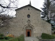 ArnadSan Martino, with three aisles, is the most important example of Romanesque in the Aosta Valley