 The Aosta Trip
Ru de la Plaine
Irrigation channel of 1325 bringing Valtournenche water to Châtillon and Saint-Vincent
The path follows the ru almost on the level, through vineyards and woods, with views over the valley floor and Ussel Castle. It reaches La Verdettaz, where the section coming up from Saint-Vincent joins it.

Trails
- from Via Battaglione Aosta (621 m) · ↑ 51 m · 1 h 14 min out, 1 h 10 min back · 4.7 km · E Walk · path 111 · June, July, August, September, October
Trails: data provided by the Struttura Forestazione e Sentieristica of the Aosta Valley Autonomous Region.
History
The ru follows a short stretch of the ancient Via Francigena.
Nearby
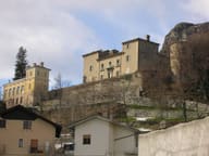 Passerin d'Entrèves CastlePrivate castle; entry to the park with monumental trees is free
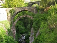 Châtillon Roman BridgeThe Roman abutments, with a 15-metre arch, still carry the bridge over the Marmore
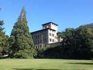 Gamba CastleIn the park, among 150 trees, grows a California giant sequoia
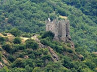 Ussel CastlePassed to the Region in 1983; linked to Marcel Bich, the Bic pen baron
- Casinò de la ValléeOpened on 29 March 1947 in the Grand Hôtel Billia; today 3,500 m² and over 400 slots
- Saint-Évence ChapelChapel of medieval origin on a plateau above the Valtournenche, within sight of the Matterhorn