 The Aosta Trip
Gressoney-Saint-Jean Cross-Country Trails
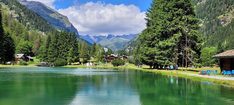
Around Lago Gover, in the village, a 5.2 km loop is lit for skiing in the evening
The trails start from Lago Gover, in the village centre, where the cross-country ski school chalet stands. From there linked loops, easy or of medium difficulty, climb to the Dresal plain and towards Rong and Biel. The full circuit of the Monterosalauf trail is 22 km, and the network reaches 25. The Lago Gover loop (5.2 km) is lit, and 3 km around the lake have snowmaking. From the trail you can see the Lyskamm, in the Monte Rosa massif.
European Cup races, World School Championships and Italian Championships have been held here, and cross-country skiers such as Federico Pellegrino and Francesco De Fabiani train here. The short loops at Lago Gover have international FISI homologation until 2027 and 2028. In the evening there are night outings with lessons.

Visiting
Winter season, trails open from 9:00 to 16:30 (2026/27 dates not yet published). 2025/26: day pass €8, concession €6, afternoon pass €5; local season pass €60 or €70, and the regional season pass is also valid. Tickets at the cross-country ski school at Lago Gover, at the Bar Sport, at the Bar Lorelei, at the Monterosa Ski ticket office in Weissmatten and online at scinordicovalledaosta.it. The largest car park is at Weissmatten, a small one in the centre near the start.
Pistes
Monterosalauf trail, 22 km — The full loop is red, of medium difficulty with demanding sections, and has 110 m of height difference. From Lago Gover it climbs to the Dresal plain and, with a short, steep climb, towards Rong; it comes back gently downhill towards the village, passes behind the lake again and along an undulating section reaches the Bino area.
Castel Savoia and Weissmatten — After Bino the trail climbs among larches and firs towards Castel Savoia, reaches Weissmatten with a few ups and downs and descends to the turning point at La Stella. It climbs back to Weissmatten, passes through Biel, passes below the castle again and returns downhill to Lago Gover.
Short loops — Dresal, 3 km, easy; Rong, 4.5 km, red; Castello-Biel, 4 km, blue or of medium difficulty; Wald, 2.7 km, of medium difficulty; Champsil, 2.2 km, easy.
Lago Gover loop, 5.2 km — Red, lit for the evening. The roughly 2.5 km at Bino were the first section with snowmaking; today snowmaking covers 3 km around the lake.
FISI homologations — At Lago Gover a 1.4 km course is homologated for international races, until 2027, and the 2.5 km blue, 2.5 km red, 3.3 and 3.75 km courses, until 2028.
Nearby
 Gressoney-Saint-JeanOn the beams of the Walser merchants' houses, a heart topped by a 4
 Beck-Peccoz Regional Museum of Alpine FaunaCollection of about 90 antique weapons and hunting trophies with horn anomalies
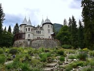 Castel SavoiaFirst stone laid on 24 August 1899 in the presence of Umberto I
- Gressoney-Saint-Jean, WeissmattenThe Leonardo David run is floodlit: on some evenings you can ski at night
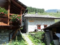 Rifugio Alpenzu GrandeInside Alpenzu Grande, a Walser village recorded as early as 1249
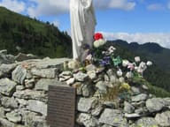 Colle RanzolaA plaque to Tolstoy, who came this way in 1857, and a dry-stone wall from 1800 against Napoleon