 The Aosta Trip
Gressoney-La-Trinité Cross-Country Trails
In November 2025 there was already skiing on a loop made with snow stored from the winter
Two loops start near the village, between 1,605 and 1,666 m. The first starts from the square at Colletesand, near the Punta Jolanda chairlift, and runs across the plain on the right side of the Lys, with views of Monte Rosa; the second, easier, goes from the church square southwards among houses, meadows and woods. In all the trails total 6 or 9.5 km; among them is the Sant'Anna loop, at 2,171 m, which you can reach by cable car from Staffal.
On 8 November 2025 a loop of almost one kilometre was opened at Onderwoald using snowfarming: 10,000 cubic metres of snow from the previous winter, stored under covers, with a loss of 35%. The project is supported by the regional administration and by Monterosa Ski, with the work of volunteers and municipal employees.

Visiting
The trails are free. Opening hours: 9:00–16:30. Car parks at Colletesand and in the centre, with toilets. For the Sant'Anna loop you need a ticket for the Staffal–Sant'Anna cable car (prices at visitmonterosa.com). 2026/27 season: dates not yet published; opening depends on the snow.
Pistes
Onderwald loop, 3 or 3.5 km — Blue, of medium difficulty. It starts from Colletesand and from Onderwald, runs across the plain on the right side of the Lys and has variants for expert skiers; you can see Monte Rosa and the cirque of the Netscho glacier. Two kilometres have snowmaking.
Village loop — Linked to the first by a section along the stream embankment, it runs across the plain south of the village, starting from the little church square, near the town hall and the Walser Museum. A simple course, with views of Mont Néry to the south; it is also open to people on foot or on snowshoes.
Other names — Gabiet (2 km, blue), Tache (2 km, easy) and Sandmatto (1.5 km, easy).
Sant'Anna loop, 2.5 km — Easy, blue, at 2,171 m. You reach it with the Staffal–Sant'Anna cable car and it is open only at certain times; information from Monterosa SpA.
On foot — A 3.5 km groomed footpath.
Nearby
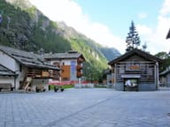 Walser EcomuseumPuròhus farmhouse from 1772, with stable and living quarters under the same roof
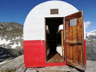 Bivacco Carlo GastaldiRed and white barrel-shaped bivouac hut on the rim of the basin of the three small Nétschò lakes
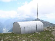 Bivacco Ulrich LateltinDreamt of in 1950 by the carpenter Ulrich Lateltin, built by his nephew in 1984
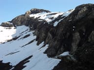 Testa GrigiaAntoine Laurent climbed it alone on 10 January 1864: the first documented Italian winter ascent
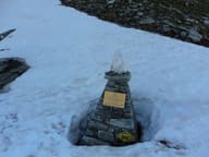 Colle PinterWalser pass between Ayas and Gressoney for grain and livestock; the Alta Via 1 crosses it
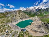 Lago GabietFirst dam to go into operation in the Aosta Valley, built between 1919 and 1923