 The Aosta Trip
Becca d'Aver
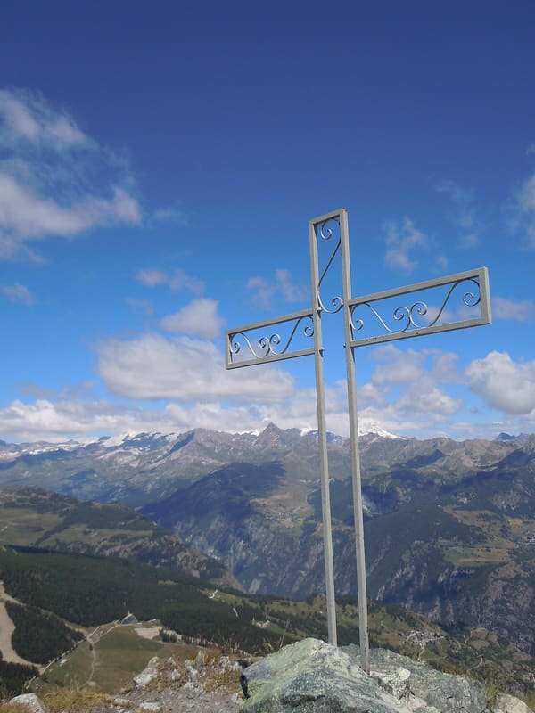
The last summit to the south on the ridge that comes down from the Dent d'Hérens, facing the Matterhorn
From the summit, marked by a small iron cross, you can see the Matterhorn, the Breithorn, the Polluce and the rest of Monte Rosa; to the south, beyond the main valley, Monte Emilius, Punta Tersiva, Gran Paradiso, the Rutor and Mont Blanc. A broad ridge joins it to the nearby Cima Longhède, slightly lower.

Trails
- from Plan Prorion (1,823 m) · ↑ 700 m · 2 h 11 min out, 1 h 19 min back · 3.4 km · E Hike · path 11 · June, July, August, September
- from Praz (1,761 m) · ↑ 800 m · 2 h 31 min out, 1 h 34 min back · 4.4 km · E Hike · path 16 - 16A · June, July, August, September
- from Châté (1,697 m) · ↑ 813 m · 2 h 55 min out, 1 h 58 min back · 6.5 km · EEA Equipped · path 9 · June, July, August, September
- from Capoluogo (1,021 m) · ↑ 1,451 m · 4 h 24 min out, 2 h 36 min back · 6.1 km · E Hike · path 2 · June, July, August, September, October
- from Crétaz (585 m) · ↑ 1,892 m · 6 h 5 min out, 3 h 52 min back · 11.3 km · E Hike · path 1 · June, July, August, September, October
Trails: data provided by the Struttura Forestazione e Sentieristica of the Aosta Valley Autonomous Region.
History
Just below the summit, above the Aver alpine pasture, there is a small chapel. On the nearby Cima Longhède there is a large cross put up by the Gruppo delle Penne Nere di Verrayes.
Nearby
- Torgnon Cross-Country TrailsThe Gilliarey loop climbs to 2,200 m, at the sanctuary, with a view of the Matterhorn
- Champlong Cross-Country TrailsOne variant passes a larch estimated to be 700 years old
 TorgnonAn 8-seater gondola goes up from the village to the Chantorné basin, at 1,868 m
- Saint-Barthélemy Cross-Country TrailsThe Lo Gran Tor loop is 30 km long, between 1,960 m at Praz de l'Arp and 2,014 m at the Ollière
 Petit-Monde Ethnographic MuseumRow raccard, grange and grenier from 1463–1700 at Triatel, with a mill on the stream
 Aosta Valley Astronomical Observatory and Lignan PlanetariumOn the Teaching Terrace, seven 25 cm telescopes host the Saturday night tours